
****This station is located in the French Quarter park****
include("nws-alerts.php");
 Follow @westweather716
| |||||||||||||||||||||||||||||||||||||||||||||||||||||||||||||||||||||||||||||||||||||||||||||||||||||||||||||||||||||||||||||||||||||||||||||||||||||||||||||||||||||||||||||||||||||||||||||||||||||||||||||||||||||||||||||||||||||||||||||||||||||||||||||||||||||||||||||||||||||||||||||||||
45°F
Updated:
19-Apr-2024 4:35am

NAVIGATION
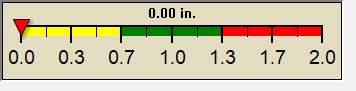
24 HOUR SNOWFALL
STATE EXTREMES
High Temperature
80°F at El Centro Naf, CA
Low Temperature
-4°F at North Island Nas, CA
High Precipatation
1.36in at Mount Shasta Amos, CA
Data courtesy of NWS-CPC
USA EXTREMES
High Temperature
99°F at Castroville Muni Tx, TX
Low Temperature
-4°F at North Island Nas, CA
High Precipatation
1.36in at Mount Shasta Amos, CA
Data courtesy of NWS-CPC
Alerts
Affiliations
 --------------------
 --------------------
 716-503-ANDY
Find Lost Dogs