
****This station is located in the French Quarter park****
include("nws-alerts.php");
 Follow @westweather716
| |||||||||||||||||||||||||||||||||||||||||||||||||||||||||||||||||||||||||||||||||||||||||||||||||||||||||||||||||||||||||||||||||||||||||||||||||||||||||||||||||||||||||||||||||||||||||||||||||||||||||||||||||||||||||||||||||||||||||||||||||||||||||||||||||||||||||||||||||||||||||||||||
55°F
Today is Thursday,
Data From A Personal Weather Station In West Seneca,NY
Data From A Personal Weather Station In West Seneca,NY
Updated:
18-Sep-2025 1:55am

NAVIGATION
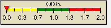
24 HOUR SNOWFALL
STATE EXTREMES
High Temperature
107°F at Needles, CA
Low Temperature
36°F at Alturas Municipal Ap, CA
High Precipatation
none
Data courtesy of NWS-CPC
USA EXTREMES
High Temperature
120°F at Glendale Municipal Airport, AZ
Low Temperature
29°F at Angel Fire Airport, NM
29°F at Stanley Ranger Station, ID
High Precipatation
7.32in at Oceana Nas, VA
Data courtesy of NWS-CPC
Alerts
Affiliations

 --------------------
 --------------------
 716-503-ANDY
--------------------
716-503-ANDY
--------------------