****This station is located in the French Quarter park****
include("nws-alerts.php");
 Follow @westweather716
| |||||||||||||||||||||||||||||||||||||||||||||||||||||||||||||||||||||||||||||||||||||||||||||||||||||||||||||||||||||||||||||||||||||||||||||||||||||||||||||||||||||||||||||||||||||||||||||||||||||||||||||||||||||||||||||||||||||||||||||||||||||||||||||||||||||||||||||||||||||||||||||||||
46°F
Today is Friday,
Data From A Personal Weather Station In West Seneca,NY
Data From A Personal Weather Station In West Seneca,NY
Updated:
01-May-2026 5:05pm

NAVIGATION
24 HOUR SNOWFALL
STATE EXTREMES
High Temperature
96°F at Desert Resorts Regional Ap, CA
Low Temperature
25°F at Bridgeport Sonora Junction, CA
High Precipatation
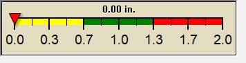
none
Data courtesy of NWS-CPC
USA EXTREMES
High Temperature
97°F at Gulf Shores Jack Edwards Ap, AL
97°F at Castroville Muni Tx, TX
Low Temperature
-10°F at Middlesboro Bell County Ap, KY
High Precipatation
6.81in at Driggs-reed Memorial Ap, ID
Data courtesy of NWS-CPC
Alerts
Affiliations
-

-

-
 westsenecaweather
-
Kaz home improvements

 --------------------
 --------------------
 716-503-ANDY
--------------------
716-503-ANDY
--------------------

Style Options